File:Map of Arad.png
Jump to navigation
Jump to search
Size of this preview: 800 × 547 pixels. Other resolutions: 320 × 219 pixels | 640 × 438 pixels | 1,024 × 701 pixels | 1,280 × 876 pixels | 2,011 × 1,376 pixels.
Original file (2,011 × 1,376 pixels, file size: 362 KB, MIME type: image/png)
Captions
Captions
Add a one-line explanation of what this file represents
Summary
[edit]
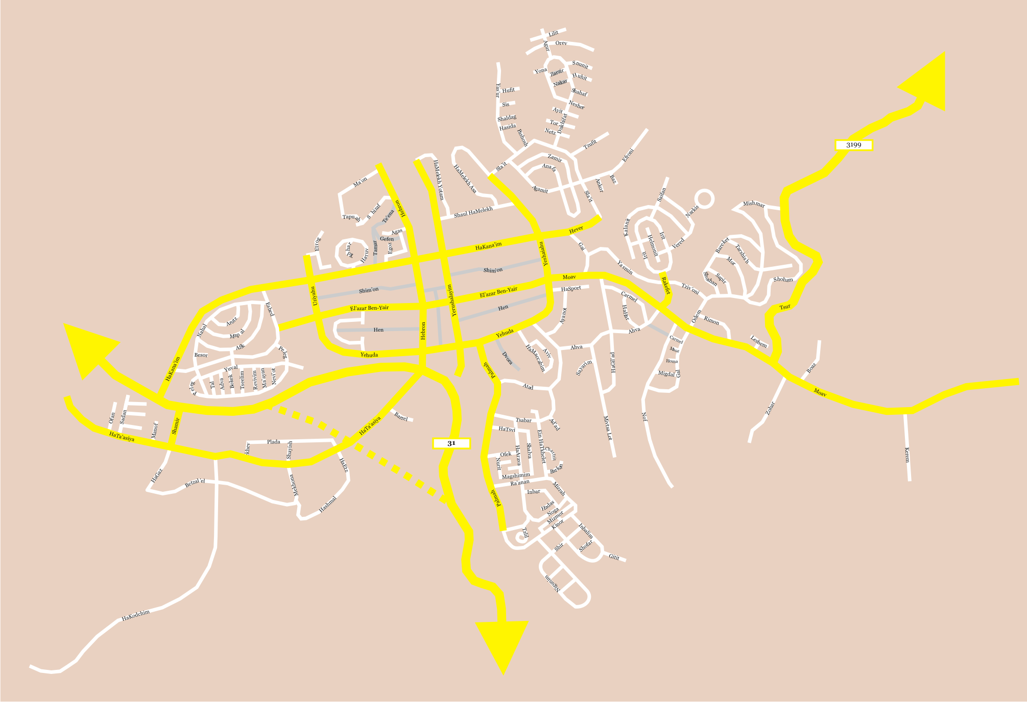
| Description | Street map of Arad, Israel, made by me. |
| Date | 3 March 2006 (original upload date) |
| Source | No machine-readable source provided. Own work assumed (based on copyright claims). |
| Author | No machine-readable author provided. Ynhockey assumed (based on copyright claims). |
Summary
[edit]
Street map of Arad, Israel.
Yellow = major road
White = minor road
Grey = non-paved or asphalted street
Licensing
[edit]
I, the copyright holder of this work, hereby publish it under the following licenses:

|
Permission is granted to copy, distribute and/or modify this document under the terms of the GNU Free Documentation License, Version 1.2 or any later version published by the Free Software Foundation; with no Invariant Sections, no Front-Cover Texts, and no Back-Cover Texts. A copy of the license is included in the section entitled GNU Free Documentation License. |
| This file is licensed under the Creative Commons Attribution-Share Alike 3.0 Unported license. | ||
| ||
| This licensing tag was added to this file as part of the GFDL licensing update. |
You may select the license of your choice.
File history
Click on a date/time to view the file as it appeared at that time.
| Date/Time | Thumbnail | Dimensions | User | Comment | |
|---|---|---|---|---|---|
| current | 22:17, 16 August 2008 | | 2,011 × 1,376 (362 KB) | Ynhockey (talk | contribs) | New version, as in the English Wikipedia. |
| 08:53, 3 March 2006 |  | 1,609 × 1,101 (338 KB) | Ynhockey (talk | contribs) | Street map of Arad, Israel, made by me. == Summary == Street map of Arad, Israel. Yellow = major road<br /> White = minor road<br /> Grey = non-paved or asphalted street |
You cannot overwrite this file.
File usage on Commons
The following page uses this file:
File usage on other wikis
The following other wikis use this file:
- Usage on ca.wikipedia.org
- Usage on nl.wikipedia.org